6-7 May 2019
Ljubljana, Slovenia
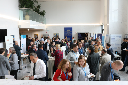
The geopreservation community gathered for the first CEF eArchiving Geopreservation conference in Ljubljana, Slovenia on the 6-7 May 2019.
The two-day event brought together producers of geospatial information, archives, data repositories and solution providers to discuss various geopreservation topics. CEF eArchiving is very proud of this first, successful, conference that facilitated the discussion around geopreservation and necessary geospatial specifications.
An increasing amount of digital information also includes a spatial component. This might be applications installed on smartphones, which help us navigate the traffic or support food-delivery services. Spatial data preservation is therefore an important topic to discuss and one which needs greater awareness. Policy decisions, such as infrastructure or mobility developments, are dependent on spatial information. However, the environment in which all this information is created and managed is not made with long-term preservation in mind. Decades of experience with digital spatial data management shows the preservation of data especially the urgency to maintain data usability over time.
This is why the CEF eArchiving Building Block team organised this conference, promoting common specifications and how they can facilitate the preservation of geospatial data preservation to build a Digital Single Market. The CEF eArchiving Building Block, built on the E-ARK specifications, is the driver for long-term information assurance, meaning that digital preservation, records management, and digital archives in general are recognised as critical pillars for the Digital Single Market. The building block offers services, such as training materials and a service desk to help interested entities get started with geopreservation, or data preservation in general.
This conference enabled geopreservation experts to come together and discuss key factors that affect the handling of geospatial data, its preservation and its further usability. It connected different geospatial community stakeholders (data creators, regulators, solution and service providers, archives, academia) from Europe and around the world, offering an opportunity for them to share their experience and solutions, face their common challenges and issues, and learn from each other.
Full day video streams: Day 1 | Day 2
Presentations
Day 1
- Anne-Sofie Jensen, “The increasing value of Geodata – and why preserving it is important” – Presentation | Video
- Sophia Bünemann, “CEF at the Geopreservation Conference” – Presentation | Video
- Janet Anderson, “The CEF eArchiving Building Block” – Presentation | Video
- Dalibor Radovan , “Spatio–temporal indicators for optimal geodata archiving” – Presentation | Video
- Valerie Gouet-Brunet, “Time Machine: the big data of the past for the future of Europe” – Video
- Žiga Zwitter, “Linking Archival Records, Geodata and Other Maps in Environmental History Analyses” – Presentation | Video
- Jakob Eiby, “Archiving geodata” – Presentation | Video
- Gregor Završnik, “Long term preservation formats for Geodata” – Presentation | Video
- Rink W. Kruk, “Geodata as Instrument, Archival matter and Connector” – Presentation | Video
- Gašper Rutar, “Geodata in archaeology. What and why we record, what and why should we preserve?” – Video
- Brett Abrams, “Formats for GIS & Design Records at NARA” – Presentation | Video
- Mateja Urbančič, “The overview of EC INSPIRE Directive” – Presentation | Video
- Joan Masó, “ISO 19165 Metadata model for preservation and Open Packaging Convention for data and metadata preservation example” – Presentation | Video
Day 2
- Tomaž Černe, “Integrating Opensource GIS solutions into a functional Archival system” – Presentation | Video
- Želimir Župljanin, “FME – a leading technology for spatial data transformation” – Presentation | Video
- Gregor Završnik, “E – ARK4ALL – Solutions for archiving geodata” – Presentation | Video
- Primož Kogovšek, “EARK Pilot Experiences in archiving Natura 2000” – Presentation | Video
- Boštjan Pucelj, “Digital Archive of Geospatial Data” – Presentation | Video
- Sandor Biszak, Arcanum “MAPIRE: the historical map portal” – Video
- Andras Sipos, “Access to historical geodata via Hungaricana Portal and Budapest Time Machine” – Presentation | Video
- Rebeccah Baker, “Preserving Federal Geodata at NARA” – Presentation | Video
- Michal Hanzalík, “Piql Preservation Services” – Presentation | Video
- Jaka Šimnovec, “Archiving of spatial data and Access through the GIS for Local Authorities PISO” – Presentation | Video
- Vlatka Lemić, “Topotheque– collaborative portal for archives and communities “ – Presentation | Video
- Hrvoje Stančić, Rina Milošević, “Enhancing evidentiary value of land registry records by the use of blockchain” – Presentation | Video
- Round table discussion and conclusions – Video